|
Tasmanian Bush Fires - High Resolution Satellite Images
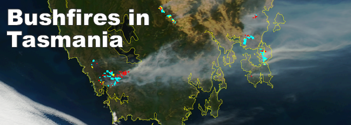
Bush Fires ravaged Tasmania in early January devastating many local communities.
Direct broadcast satellite data is being used to monitor the firefighting efforts and the spread of the fire throughout the state. These images received from NASA's TERRA and AQUA satellites on 6/1/2013 show the large plumes of smoke and the red, yellow, cyan pixels are for bush fires that occurred in the last 12, 24, 36 hours giving firefighters valuable information about the size and direction of the fires.
The images below were captured by the SATRAX-XL groundstation located at ES&S Headquarters in Richmond, Victoria.
For more information about satellite imagery for firefighting purposes or other inquiries please contact ES&S
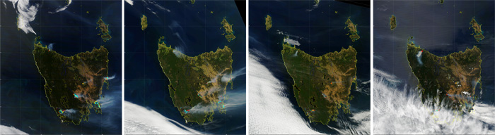

click on the specific images for a full high resolution satellite image of that particular time.
|