| |
X-band satellite images of
bushfires |
|
| |
09
Jan 2007 |
|
| |
|
|
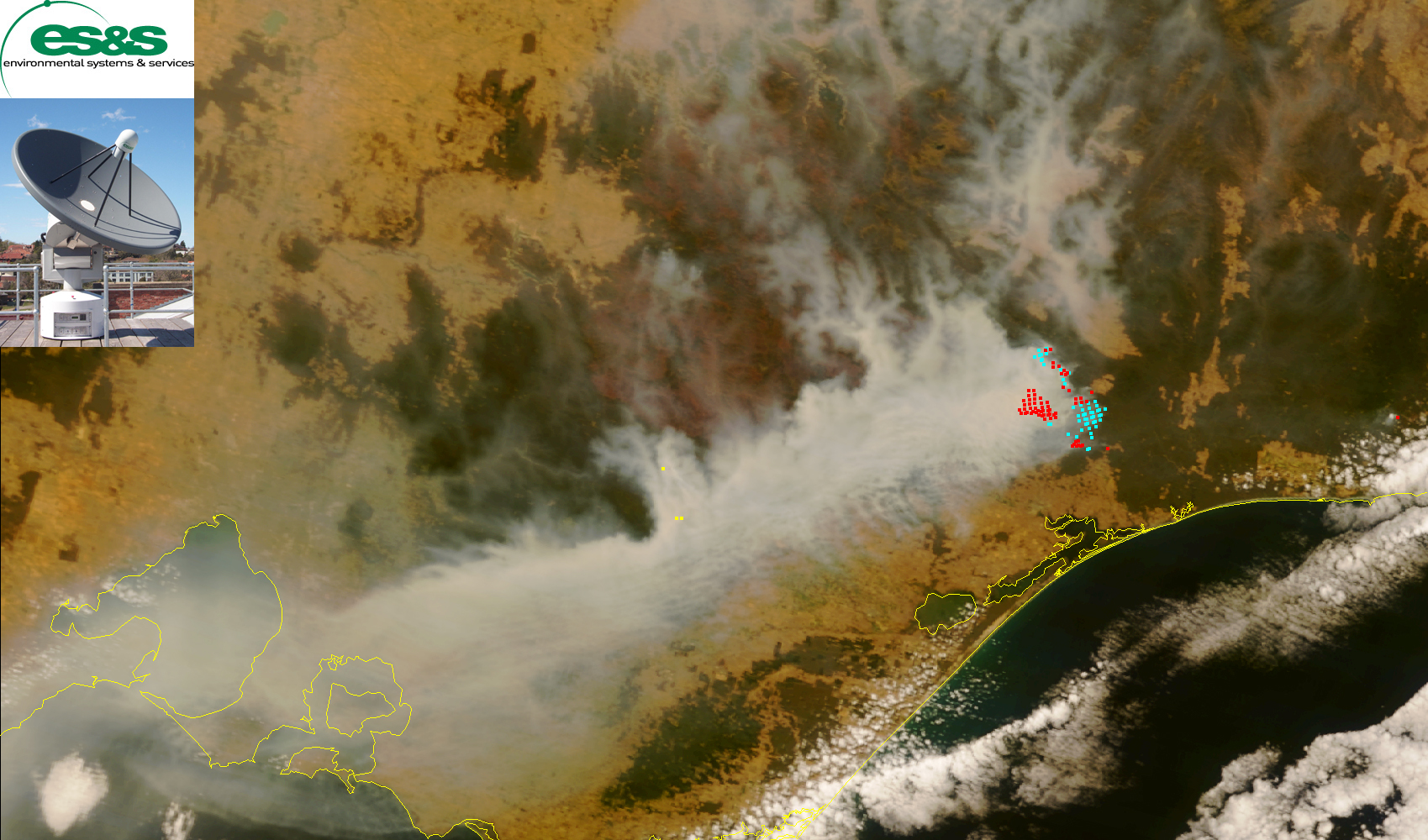
Images
of local bushfires are being produced by the ES&S Satrax-700
X-band satellite ground station after every overhead
pass by the X-band satellites Terra and Aqua. Images are processed
by the Satrax ModApps software,
which contains many image processing products, one of which automatically
pinpoints hot spots on the satellite image. This system can be
used to provide automatic notification of thermal anomalies to
emergency management authorities to help manage fire events.
The image below shows why smoke has appeared over Melbourne today.
It also shows the areas affected by the December 2006 bushfires,
which appears as reddish-brown colouring to the
northwest of the current fires near Bairnsdale.
 (larger
image) (larger
image)
View December bushfire satellite images
here
|
|
|
|
 (larger
image)
(larger
image)