| |
ES&S Software implements
automated navigation correction |
|
| |
30
May 2008 |
|
| |
|
|
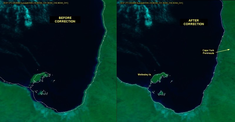
As
part of its extensive satellite processing suite, ES&S has
added an AAPP based automated navigation package by METEO France
which greatly improves the geographic location of received older
generation satellite images. Using previously defined landmark
points, the software automatically corrects for errors in the received
raw data, to allow more accurate overlaying of coastlines, roads,
political boundaries and other GIS features.
 |
|
|
|