|
|
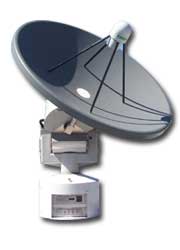
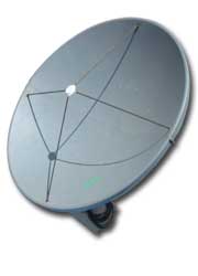
Satrax 800 X/L Dual Band
SATELLITE RECEPTION SYSTEM |
FEATURES
• High precision X/L-band reception
• XY tracking mount
• Flexible and upgradeable
• Dynamic Tracking
• Robust design for use without a radome
• Excellent demodulation loss
• Utilises the ESS3000 multi-mode receiver
• Compatible with Windows & Linux OS
• Interfaces with the very powerful METEOR
• Satellite Image Processing Package
• S-band option (Satrax XLS)

APPLICATIONS
The SATRAX-X/L is a high performance
groundstation designed to receive data from the new generation
of X and L band satellites.
The latest technologies and techniques have been used to
produce a system which implements all the functions required
to automatically track, receive, demodulate and process remote
sensing data in real time with minimum user intervention. In
addition, high speed processing on scientific workstations
allows the generation of user specified high level products of
selected regions of interest.
|
|
|
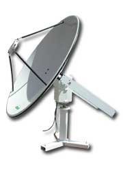
Satrack 150 NOAA
1.5M NOAA RECEPTION SYSTEM |
FEATURES
• Very low cost
• Small size
• Easy installation
• Complete with radome
• Integrated tracking software
APPPLICATIONS
• Reception of NOAA satellite data
• Options for SeaWiFS & DMSP reception
|
|
|
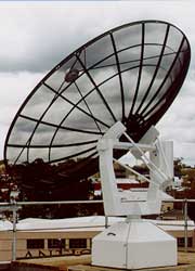
Satrak 500 Pol-Geo
3.6M POLAR & GEOSTATIONARY GROUNDSTATION |
FEATURES
• Integrated reception and control system
• Multi-mode scheduling reduces conflict
• Complete turn-key system
APPLICATIONS
• Reception of polar orbiting
• & geostationary satellites
|
|
|
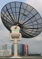
GEOSAT500 MTSAT HRIT
MTSAT RECEPTION SYSTEM |
FEATURES
• Totally automated reception
• Fully customizable interface
• Integrated data transmission service
• Multiple Image processing system compatibility
• Linux OS
APPLICATIONS
• Reception of MTSAT HiRID, HRIT, LRIT data
• Processing of geostationary satellite images
|
|
|
GEOSAT400 COMS1 & MTSAT LRIT
Satellite RECEPTION SYSTEM |
FEATURES
• Fixed parabolic dish
• Feed, LNA and Downconverter
• Ingest processing & display workstation
• Low Rate Info Transmission (LRIT)
• reception
• METEOR LT powerful image processing
APPLICATIONS
The GEOSAT400 is designed to receive data from the Japan Meteorological
Agency’s MTSAT spacecraft. It is a complete turn-key system,
providing all hardware and software necessary to receive
Low Rate Information Transmissions from the spacecraft and
process data into image files.
iT comprises a fixed
parabolic dish, LNA, downconverter, and an Ingest data
processing and display workstation. ThE workstation processes
the incoming data, producing unique products for display and
enhancement by the METEOR LT image processing system.
|
|
|
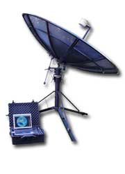
GEOTAC300 Portable LRIT
PORTABLE MTSAT LRIT |
FEATURES
• Portable antenna with feed
• & downconverter
• Signal interface and processing unit
• Image display laptop, incorporating
• processing & ingest workstation
• Receiver
• Ingest and acquisition software
• METEOR LT image processing software
• Rugged carry cases
APPLICATIONS
The GEOTAC300 satellite groundstation is a portable, high
reliability, high-performance system designed to receive data
from the Japan Meteorological Agency’s MTSAT-1R spacecraft.
It is a complete turn-key system, providing all hardware and
software necessary to receive CCSDS transmissions from the
spacecraft and process the data into image files.
The antenna and receiving equipment are easily transported
in ruggedized cases, and can be quickly erected at remote
locations.
|
|
|
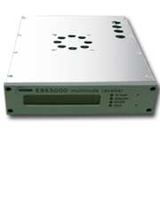
ESS 3000 Multimode Receiver
MULTIMODE SATELLITE RECEIVER |
FEATURES
• Wide range of formats
• Reception capabilities include:
• Terra & Aqua, NOAA, FY1, DMSP, GMS,
• GOES, MTSAT, HiRID LRIT & HRIT,
•
NPP/NPOESS READY
• Very low demodulation loss
• Direct network interface
APPLICATIONS
• High performance reception of
• meteorological satellites
|
|
|
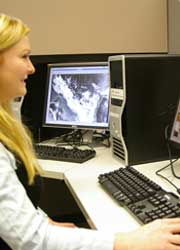
METEOR Processing Software
SATELLITE IMAGE PROCESSING SOFTWARE |
FEATURES
• Processing of satellite images
• General image processing
APPLICATIONS
• Multi-satellite processing
• All standard image processing functions
• Specialized processing of
• meteorological satellites
• High accuracy analysis
• Intuitive user interface
• Non-command driven
|
| |
|